
C-CORE has over 25 years of experience in analyzing satellite data, including radar and optical satellites with automatic identification systems from satellites (S-AIS) to extract insights on maritime situational awareness. C-CORE provides end-to-end services for rapid tasking, analytics, and dissemination of dark target information that plays a critical role in maritime surveillance.
![]()
Satellites
C-CORE is satellite sensor agnostic and uses over 60 satellites and growing satellites to detect and identify maritime targets.
C-CORE’s modeling tools identify upcoming tactical satellite passes for rapid tasking to provide threat follow-up in near real-time.
Detection/Identification
C-CORE is a world leader in EO algorithm development specializing in target detection, classification, and identification. The analytics also leverages AI to continuously improve the speed and accuracy of detection and classifications.
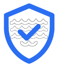
Enhanced Maritime Awareness
C-CORE leverages its easy-to-use Coresight solution delivery platform to provide dissemination of products/analytics via a web-based interface, notification services, as well as secure API access. This allows end users to quickly visualize surveillance data and increases the speed of decision making.
C-CORE’s MSS Service is directly intended to support the monitoring of EEZ, illegal fishing, illegal goods transfer, oil spill, as well as search and rescue scenarios.
Watchbox

Define, watch, task, decision
Users can dynamically define AOIs for dark target detection, anomalous activity, or environmental monitoring. C-CORE predicts ship locations and rapidly tasks high-resolution satellites for a more detailed analysis before deploying more expensive platforms, such as aircraft.
Quick Look Product

Sub-hour insights
C-CORE offers quick-look analytics alongside current AIS data for rapid insights in tactical situations. Full analytics follow shortly thereafter.
C-CORE has extensive experience in machine learning approaches to extract insight from Earth Observation data such as change detection, object detection (targets, oil spills), and object classification (ship/icebergs, etc.). C-CORE, in partnership with Equinor, ran one of the largest image classification contests on the internet using the Google-owned Kaggle platform. The machine learning competition generated over 40,000 entries from over 3,000 of the world’s best data scientists. The success of this project was based on well-curated/labeled data and underlying research to provide new EO data scientists with a running start.
For more information, contact Chris Hardy at chris.hardy@c-core.ca.
