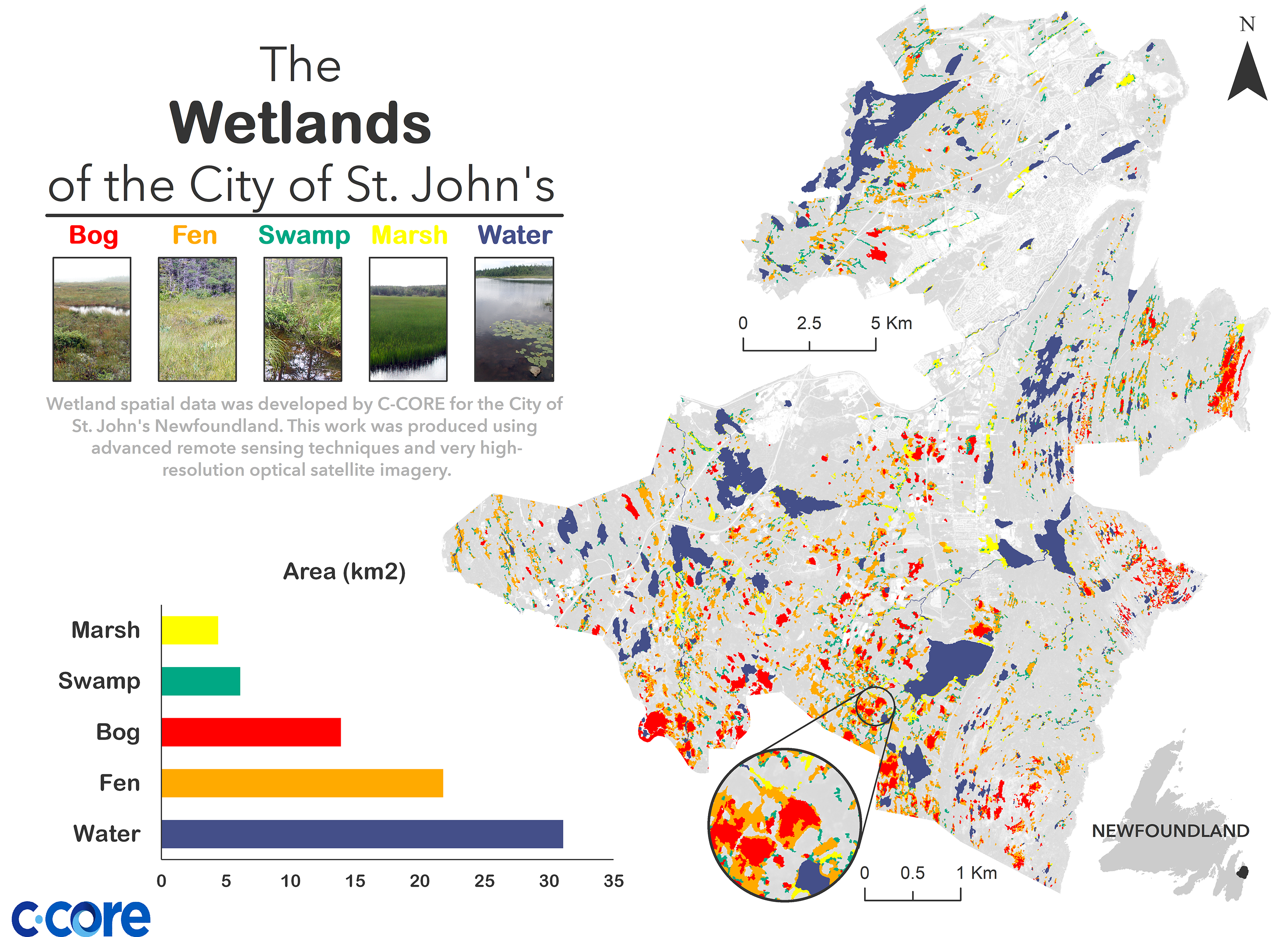
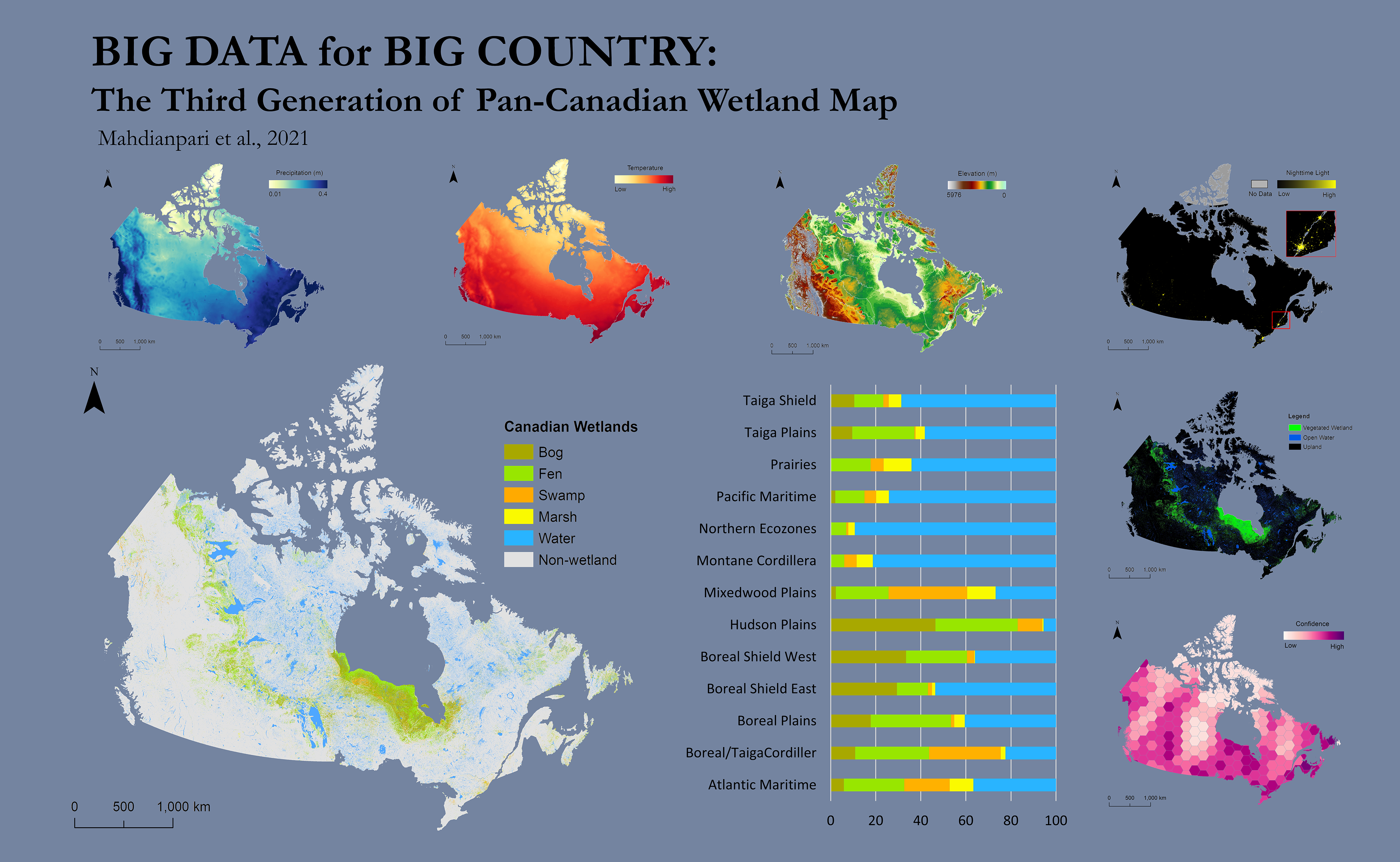
C-CORE has been developing an impressive wetland monitoring capability since 2015, supported by several organizations including NRCan and Environment and Climate Change Canada (ECCC). Monitoring is possible at local, regional, and national scales, and has grown from specific sites in Canada to a national wetlands inventory. Now, it is further expanding to a continental wetland inventory product. CCORE’s cloud-based methods have been extensively used for the production of large-scale wetland inventories across the world. The major research and development efforts at C-CORE for a series of wetland projects include:
- Ground truth data collection;
- Optical and SAR data collection;
- Earth Observation (EO) and environmental data processing;
- Developing an object-based framework on the cloud;
- Time series analysis of EO data for information extraction and change analysis;
- Machine learning development on cloud computing platforms, and;
- Building a large EO data product generation pipeline.
Through the course of three Canadian Wetland Inventory Map (CWIM) projects, C-CORE has developed world-class wetland classification products, time series analysis of satellite data, and, as a consequence, has developed an excellent publication record. These projects have expanded the global understanding of Canadian wetlands mapping through advanced data collection and processing techniques, high-level information extraction, and information dissemination in a way that is only now becoming possible.