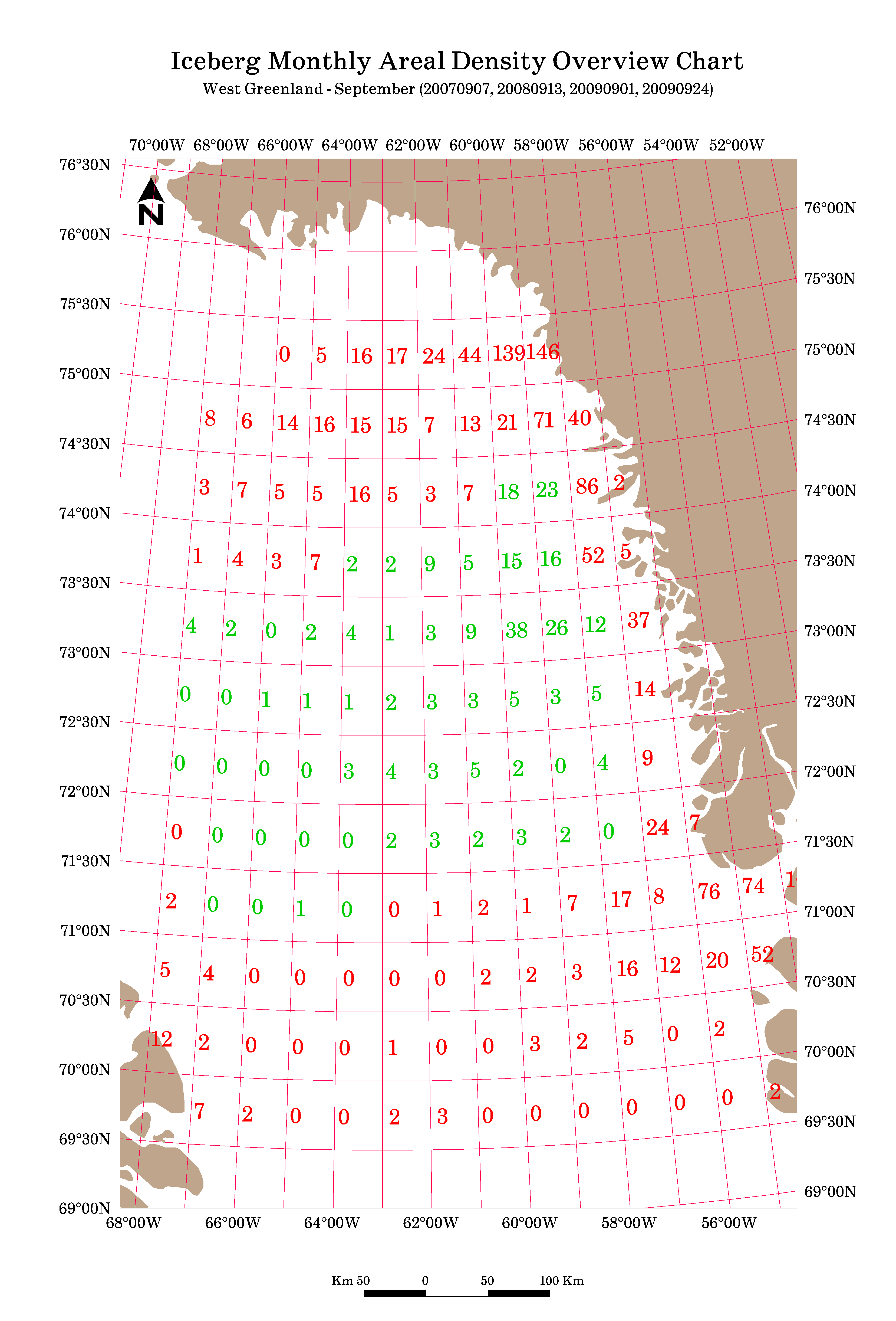
Satellites are an effective way for monitoring remote and Arctic regions. Many satellites are polar orbiting, so they collect more frequently in the Polar Regions. These synthetic aperture radar (SAR) sensors are able to operate through cloud cover and darkness. In many cases, satellites are the only source of information in some regions and are important for characterizing long term trends in iceberg conditions. C-CORE can analyze historical datasets over a number of years to indicate typical, best case and worst case ice conditions, and also suggest when and where iceberg conditions are suitable to carry out certain operations.
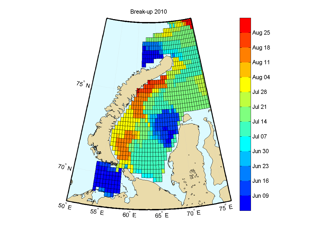
A long term historical record, largely derived from satellites, is available for sea ice conditions. However, C-CORE can analyze historical satellite images to report on detailed sea ice features such as floe sizes and deformation if required.