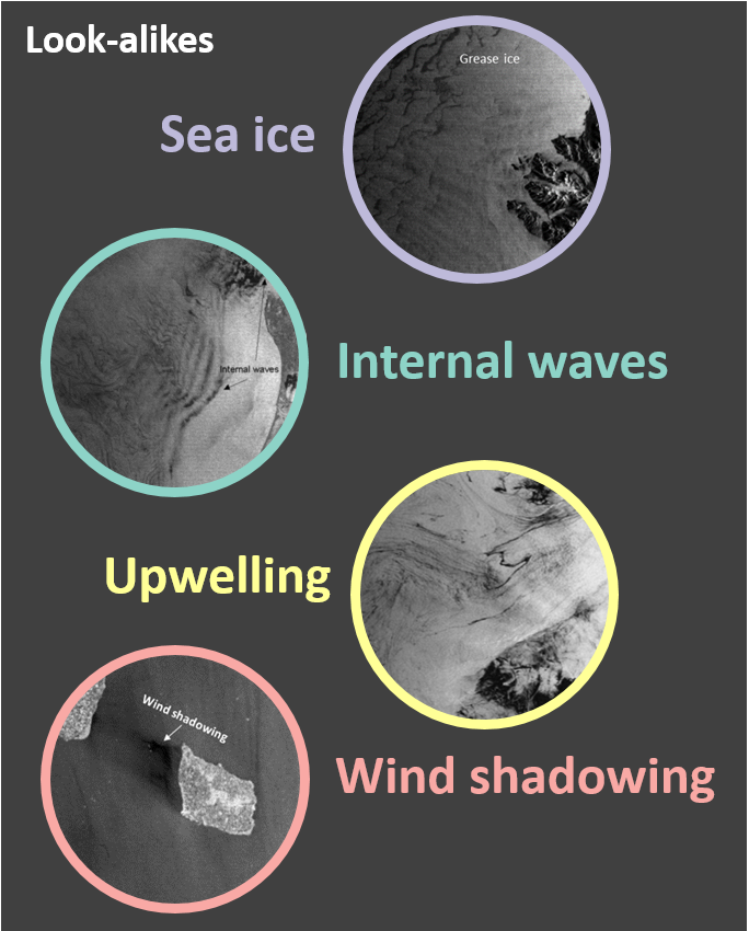
C-CORE has been researching oil spill mapping from satellites for over two decades. Oil on the water’s surface dampens capillary waves and appears dark in synthetic aperture radar (SAR) imagery. Over time the oil weathers and can be more challenging to detect. Another challenge is that other features such as low winds, algal blooms, and natural oils also appear dark in SAR. The most recent work addresses these two challenges by automatically delineating potential oil spills and discriminating them from lookalikes.
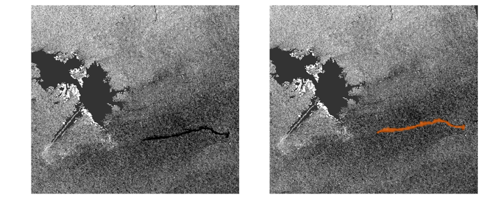
- Delineating oil spills
- Oil slicks and spills come in a wide range of shapes and sizes and their appearance changes over time. Potential oil signatures can be irregular and take a long time to manually digitize, which makes the automatic detection process both consistent and valuable.
- Discriminating spills from lookalikes
- Signatures of oil spills from around the world and lookalikes from the east coast of Canada were collected to develop a machine-learning discrimination classifier. Lookalikes will often appear in the same place and at the same time of year and have different morphology and radiometry from true oil spills and slicks.
This research is still in progress. Currently, the algorithms have been applied to Sentinel-1 VV/VH data and it has been trained against lookalikes on the east coast of Canada. Future work will expand the algorithms to more regions and data types to operationalize the process.